|
|
|
|
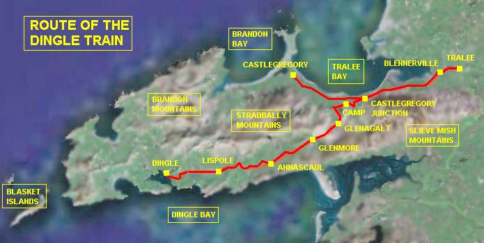
Traces of the Dingle train
(updated 2010, see below)
In the summer of 2006 I re-visited Kerry, and although on the single day I went to Tralee the steam train did not run, I managed to drive a long way into the Dingle peninsula and hunt for traces of the former Tralee & Dingle route. It was a surprise to me how steep the road really was, in view of the fact the railway followed it closely for much of the way. Tracking down the old route proved to be quite difficult - you almost need to think like a railway engineer which I am not, and even then the trackbed sometimes appeared far higher than I would have expected.
|
|
|
click on the map to enlarge |
The bridges at Camp
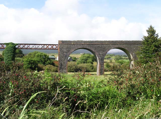
The old viaduct at Curraduff (Camp) is situated in a crooked bend of the road where it crosses the river Finglas, and the site is so cramped one needs to find a parking space further on and then brave the dense traffic to shoot a picture from the road bridge. The train crash at Camp in 1893 occurred because a special carrying passengers and pigs to Tralee ran away on Glenagalt Bank, through Camp, finally derailing on the sharp curve above the viaduct. It hit the bridge parapet and plunged into the ravine, killing three enginemen. According to 'The Dingle Train' (Plateway Press, 1996) further disaster was avoided because the guard, Thomas O'Leary, ran towards the passenger train following from Dingle and managed to stop it before it ran into the wreckage. Then how to find the deviation and the new bridge they built in 1907? I looked around on the remains of the trackbed and met the owner of a cottage behind it. He was much tickled to hear someone from Holland had come to see 'his' railway, for that is how he spoke of the old line which has gone over half a century…
We drove along the side road and ended up seeing nothing, until we asked around. The deviation route was much farther back and invisible from the road. New buildings have obliterated much of the old route, and there is a difficult to find footpath down the hill which leads to the Finglas and a field across which the bridge can be seen. We tried to negotiate the river bank but it was much too steep to come any closer.
|
|
|
|
|
The old Curraduff bridge, site of the 1893 derailment. |
The side road passing through the old viaduct (bridge abutment to the right). |
The trackbed below the cottages indicated in the plan. |
|
|
|
|
|
The girder bridge erected in 1907 when the deviation was built. Photographed from a distance as it was impossible to reach along the river. |
||
Glenagalt Bank
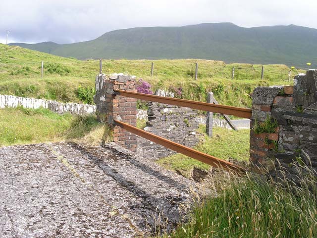
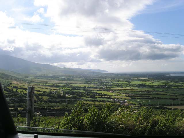
From Camp we continued up the main road to try and find more traces. The next stop was on the site of the former Skirlough crossing, where the road and the railway bed make a 90 degree turn into the mountains. Road widening has obliterated much of the former crossing site, but when looking carefully I saw a vague ridge just below the road that might just have supported a railway. Here the road is so steep the car noticed the difference. Just imagine how heavy the going must have been for a steam locomotive with 10 or more cattle vans! About halfway to the summit there was a narrow side road turning off the main road. This had cut through the old railway bed and being able to turn off the busy road enabled us to make a few photos. Eventually we came up to the remains of the bridge at the summit, on the site of the former Glenagalt platform. Here the railway turned downgrade at an angle almost as steep as the uphill route we had just followed. After more photos we continued down the road.
|
|
||
|
|
|
|
|
Looking from the site of Skirlough crossing towards Glenagalt. |
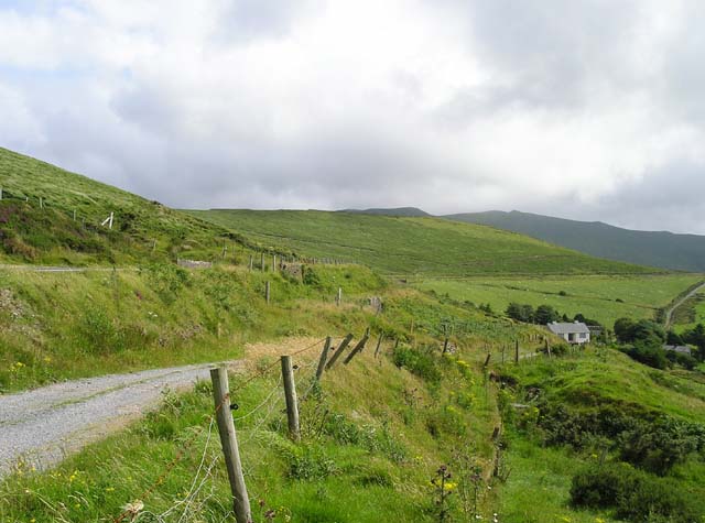
The roadbed, looking towards Tralee Bay, at a distance from Skirlough Crossing. |
Looking the other way towards Glenagalt. Note the railway route and the road lined out against the hillside beyond the side road. |
|
|
|
|
|
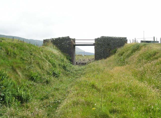
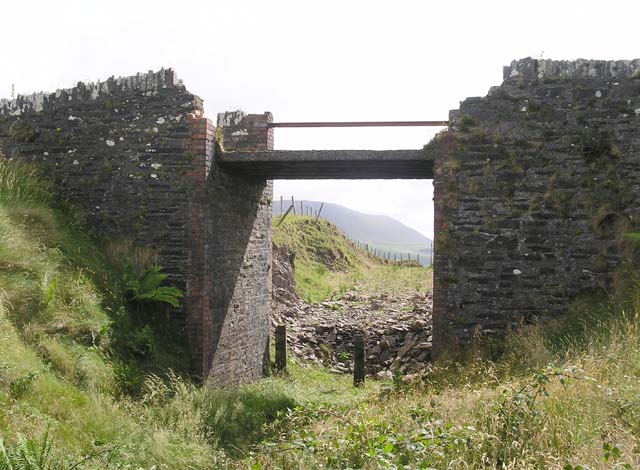
The overgrown Glenagalt platform and the disused bridge. |
The bridge, which carried a side road across the line. |
Old steel rail used as bridge rail. The bridge is a concrete slab. |
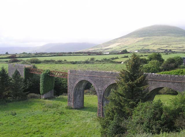
Lispole Viaduct
The final objective was Lispole viaduct, and as time was slowly running out (we had to return all the way through Tralee to Kenmare and beyond!) we spent no time searching for the remains of the Annascaul water tanks. After a tortuous route through the mountainous area formerly traversed by the railway, we ended up at Lispole and again, drove past the viaduct before we realised we had already passed through the village. On turning back we saw it standing in the field below the road on our left. We descended into the field for a few photos and then found there was a lookout point behind the fuel station beside the road. The viaduct has a monument status and therefore some viewing access has been provided. The steel girder spans are in a poor condition however, with several parts rusted through. It stands at an acute angle to the road and it is almost impossible to believe the railway turned parallel to the road without crossing it. Again, the gradient here is 1 in 29 up, which led to a Dingle-bound train running away and derailing on the sharp curve in 1907. This must have been an uncomfortable railway to work over with a steam loco and nothing but a vacuum brake between you and disaster…
|
|
|
|
|
Lispole Viaduct, seen from a field below the road. The steel span is in a very poor condition. |
||
|
|
|
|
|
Panorama of the viaduct, made from the lookout point behind the fuel station. Since the 1950s several stands of tall firs have grown to obscure the viaduct. |
||
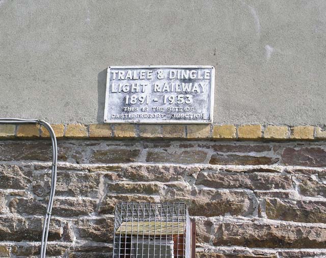
Castlegregory Junction
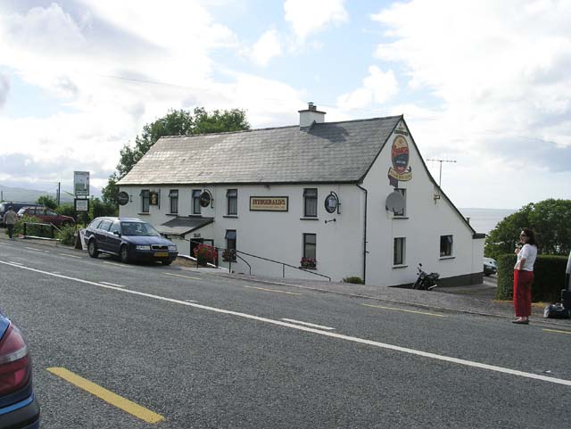
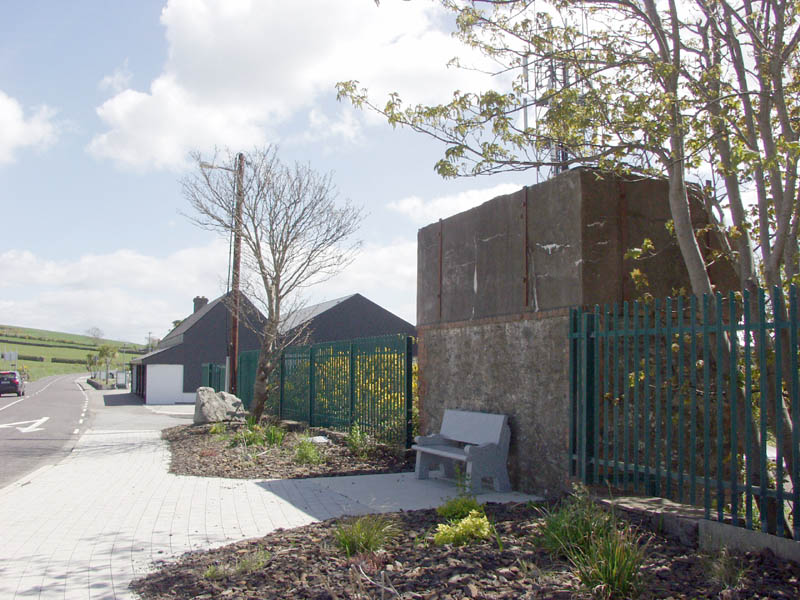
Finally, we returned to Tralee, and apart from wasting a few minutes at Annascaul to try and find where the railway had been, we carried on until we made another short stop at the site of Castlegregory Junction, a few miles out of Tralee. Here all that remains is a water tank with a plaque, and a commemorative stone erected for the 1893 crash at the Curraduff (Camp) viaduct. Across the road there is a bar named Fitzgerald's, but if the photo caption on page 132 of 'The Dingle Train' is correct, this is actually the building of Crean's pub (or Aunty's). Both were famous for visits the locomotive crews made there to have a pint whilst the locomotive was filled up at the water tank…
|
|
|
|
|
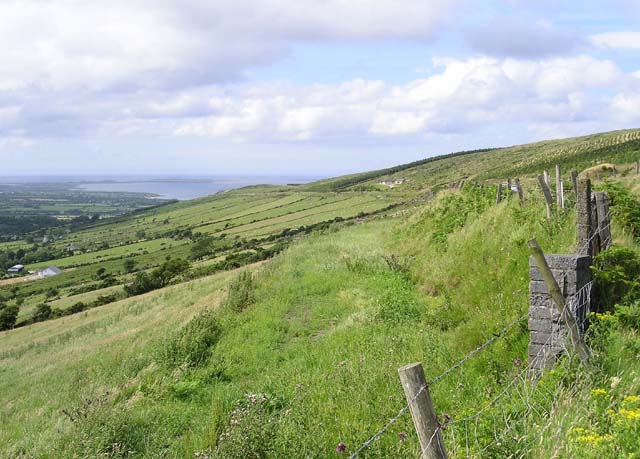
A view from the Skirlough Crossing site to Tralee Bay. The branch used to run along the coast in the distance. |
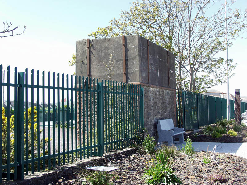
The water tank on the site of Castlegregory Junction. The site was obliterated due to road widening. |
Commemorative plaque on the side of the water tank.. |
|
|
Left: Fitzgerald's bar, where the engine crews used to have a pint for the road... Right: the commemorative stone erected to remember the Curraduff (Camp) crash of 1893. |
|
From the preceding story it might be concluded that there was nothing but bother on the Tralee & Dingle. Nothing is further from the truth however as for the locals the railway was the first reliable link to the outside world instead of a rough sea trip or a long ride in a trap over rough roads. The Blasket islanders went from Dingle into town by train, and the farmers were able to ship their cattle out to Tralee at a fraction of the cost they used to pay in the old days. Even today the older generation remembers the 'Traein an Daingean' with affection. And Ireland wouldn't be Ireland if countless colourful tales hadn't survived from the days the railway ran through the Dingle mountains. These have been admirably told in 'The Dingle Train' by David Rowlands, Walter McGrath and Tom Francis.
In hindsight, the trip down the Dingle peninsula really needed much more time - I haven't been to Dingle itself, I missed the station site at Annascaul, and I would dearly have loved driving back through the Connor Pass. Perhaps a good idea for the next time I go round there…
Update May 2010
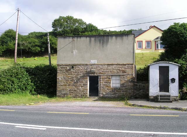
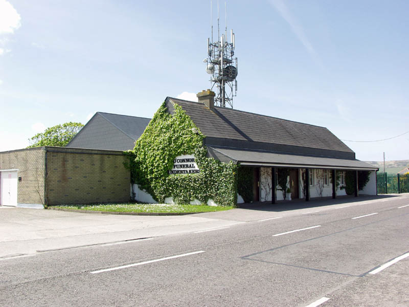
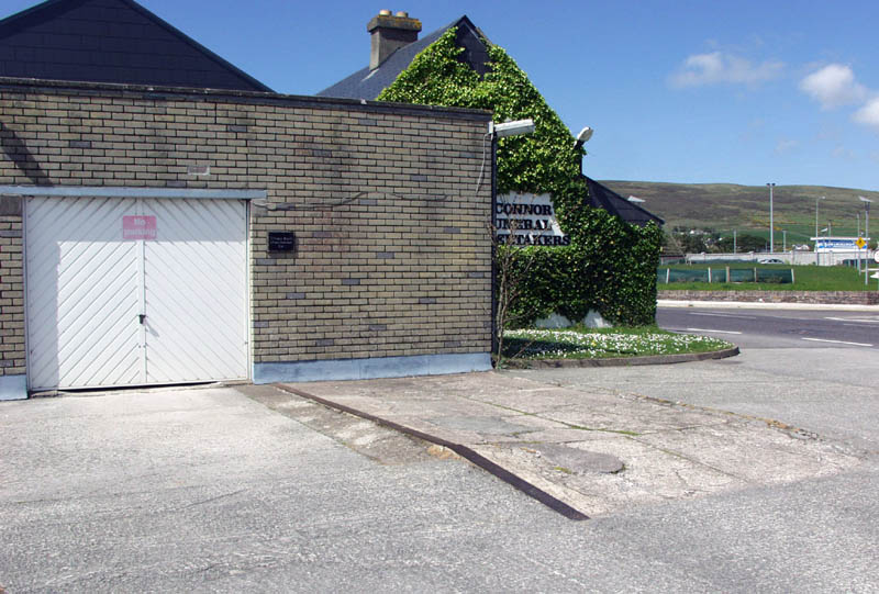
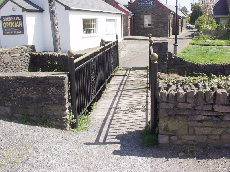
In May, 2010, I visited Dingle and in a spare moment I went hunting for remains of the old station. And surely there it was, at the edge of town: now an undertaker's premises with the train shed behind converted to some kind of storage shed. The water tank is a short distance away, and on the eastern side there is a trace of what might have been the platform edge. Across a small stream near the harbour is a pedestrian bridge which is reported to have been constructed from the girders of the old harbour branch bridge and some sleepers of the old T&D railway. Photos are below.
|
|
|
|
|
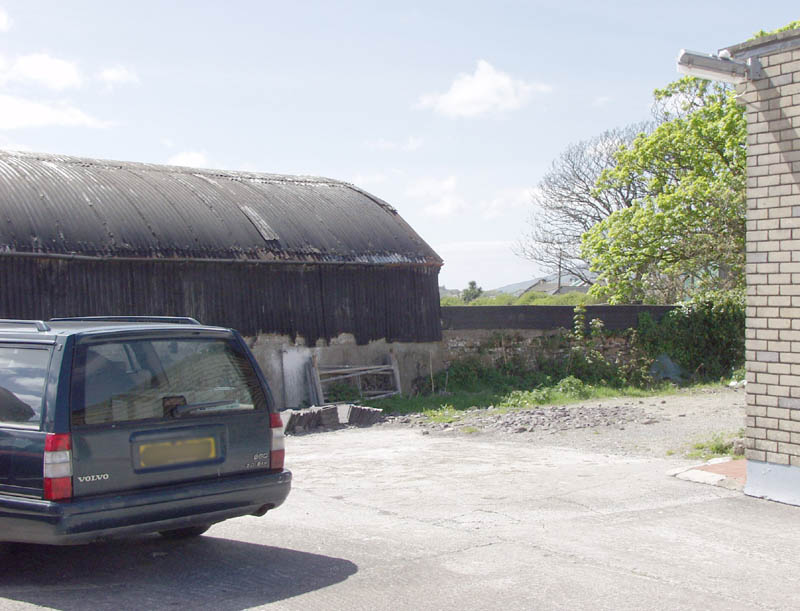
The former station building is now a funeral parlour, with a verandah added on the road side, and a garage to the left. |
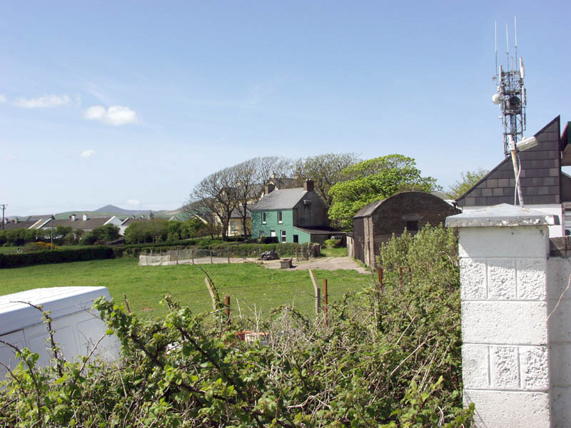
The route of the railway to Annascaul. |
The end of the present building, with a garage added to the front of the former train shed. In the pavement is what looks like the old platform edge. |
|
|
|
|
|
The cattle dock must have been where the wall of the shed is. The shed must be a later addition. |
Land on the south side of the station. I was under the impression the shed might have been the goods shed, but that was further to the west. |
The water tank. |
|
|
|
|
|
A view towards the station building. |
The pedestrian bridge across a small stream which is said to have been constructed from the girders of the Harbour branch bridge. |
Bridge deck made of old sleepers. |
.